by Mark Volt
USDA Natural Resources Connection
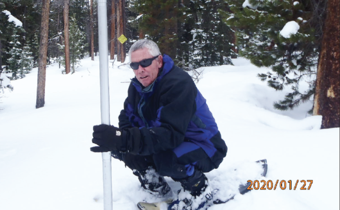
The USDA Natural Resources Conservation Service (NRCS) Kremmling Field Office snow surveyors Mark Volt and Derrick Wyle took the February 1 snow survey measurements during the last days of January.
Snowpack in the high-elevation Mountains above Middle Park is at 112% of the 30-year median. (1980-2010).
However, the snowstorm that came thru last week dumped up to 30 inches of snow, upping the Middle Park snowpack to 133% of average. The other northern and central river basins in the state also saw a 10-20% increase in snowpack during the Feb. 6-8 snowstorm. Last year’s snowpack at this time was at 117% of average. It is still early in the winter and snowpack could change significantly by May…But we’re are off to a darn good start.
Snow density is averaging 25%, which means that for a foot of snow there are 3 inches of water.
Reported readings for the major river basins as of Feb. 1 in Colorado are also doing well.: The upper Colorado River Basin averages 107%; Gunnison River Basin, 101%; South Platte River Basin, 111%; Yampa and White River Basins, 114%; Arkansas River Basin, 111%; Upper Rio Grande Basin, 107%; San Miguel, Dolores, Animas, and San Juan River Basins 105%; and the Laramie and North Platte River Basins 105% of average for this time of year. Again… the northern and central mountain snowpack increased 10-20% after the Feb. 6-8. Snowstorm.
Most of the snow courses around Middle Park have been read since the 1940s. Snow course readings are taken at the end of each month, beginning in January and continuing through April. March is historically the snowiest month, and the April 1 readings are the most critical for predicting runoff and summer water supplies, as most of our high-country snowpack peaks around that time.
For further information, including real-time snow and precipitation data for SNOTEL (Automated Snow Telemetry) sites, visit https://www. co.nrcs.usda.gov/snow/index.html.


