by Marissa Lorenz
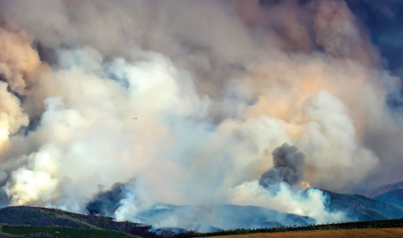
A fire broke out on the Williams Fork in the Arapaho-Roosevelt National Forest on Friday just before noon. Starting southeast of Kremmling and just north of the Henderson Mill facilities, the fire has since been determined to be human-caused. It continues to grow in size and necessary response.
At last update, it totalled 6,726 acres and was 3% contained. Friday’s initial response included Grand County Sheriff’s Office, EMS, US Forest Service Sulphur Ranger District, BLM, and all local fire protection districts. It was estimated at about 250 acres in a remote forest area heavy with standing and downed beetle kill and little road access. By the end of day Friday, the fire had grown to over 1,500 acres and was moving toward the northeast, growing concern for the possibility of moving towards Fraser.
A Type II fire incident response team was brought in over the weekend to provide greater resources and response. And by Tuesday night, the Great Basin Type 1 Incident Management Team 2 assumed command of the fire. 226 personnel are included in the current response.
Type I indicates the most complex fire response, requiring national resources for safe and effective management and operation. Type I response may continue long-term and, on Tuesday, Grand County Sheriff Brett Schroetlin noted that containment was now expected to be reached at the end of October, adding about a month to the previously anticipated length of burn.
Wednesday’s morning incident report indicated that the fire had only increased by a few hundred acres the previous day with recent weather conditions allowing firefighters to make progress in containing the fire. Containment is taking place in the northwest area of the fire along County Road 30.
Evacuation preparation
Evacuation was done in the immediate fire region on Friday. Pre-evacuation orders and activities have been put in place for the Williams Fork area, including Aspen Canyon Ranch and Henderson Mill, and the area above Fraser, near the Crooked Creek Ranch-Young Life Camp.
The fire is burning toward the southeast and an operation commander stated on Monday that the fire would have to have very specific weather conditions and pass some terrain changes to reach the Fraser Valley. He indicated that there would be several days notice if those conditions were in place and Fraser and Winter Park were endangered. “The fire is far from these areas,” he reiterated.
Sheriff Schroetlin emphasizes that the pre-evacuation plans are for the matter of preparedness and efficiency. They do not indicate an immediate danger to these areas.
Stage III Fire Ban
On Tuesday, the Grand County Board of County Commissioners resolved to put in place a Stage III total fire ban in the fire area, in accordance with US Forest Service-defined boundaries. The order allows Grand County Sheriff’s Office to enforce the ban in the forest.
Resources
Facebook has a dedicated page for the Wiliams Fork Fire at Williams Fork Fire Info. A daily interactive live-stream update is scheduled to take place on the site each night at 5pm.
Grand County has put up a dedicated resource for latest updates, signing up for Red Code updates, fire perimeter maps and interactive pre-evacuation maps, air quality conditions, informational videos and more. Go to co.grand. co.us/1331/Williams-Fork-Fire


